The grander journey? Life on the road in an RV, and RV travel…
The weather made me do it! Yep, a major cold front passed through last night. Temperatures today in Vernal (elevaton 5400 ft.) remained in the low to mid 50’s. It was our first truly “below normal” day in quite a while! With “atmospheric instability”, I knew showers were going to roll in this afternoon – and at higher altitude, that meant SNOW was likely.
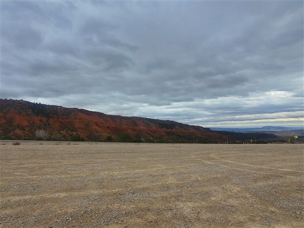
AND… SNOW it did as I headed into the nearby Uinta Mountains to the Red Cloud Loop
One of the unique things about Vernal is its proximity to the Uinta Mountains. The Uinta’s are the only east-west mountain range in the Continental U.S. and you can reach them in a half-hour from downtown Vernal. Seeing the weather change, I left the one and only coffee shop in Vernal (Beans and Brew) and headed up 2500W to Taylor Mountain Road.
Taylor Mountain Road – The “back-route” to the Red Cloud Loop
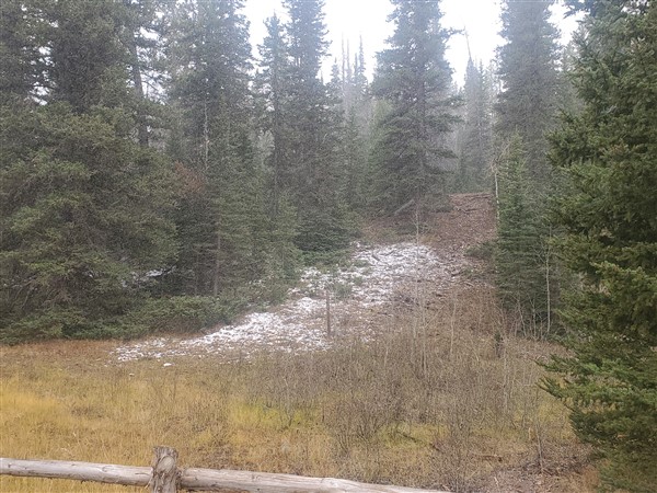
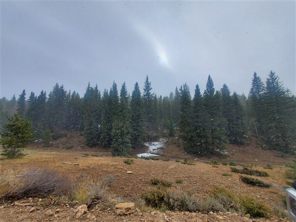
Starting out at 5600 ft., 2500W and Taylor Mountain Road climb to the Red Cloud Loop. When you reach the Red Cloud Loop, you’ve reached about 9000 ft. above sea level. Temperatures fell from 55 in town to 35 at the loop – and it was snowing! Snowing enough to start sticking to the ground, even though the weather has been warm and the ground is still far from freezing.
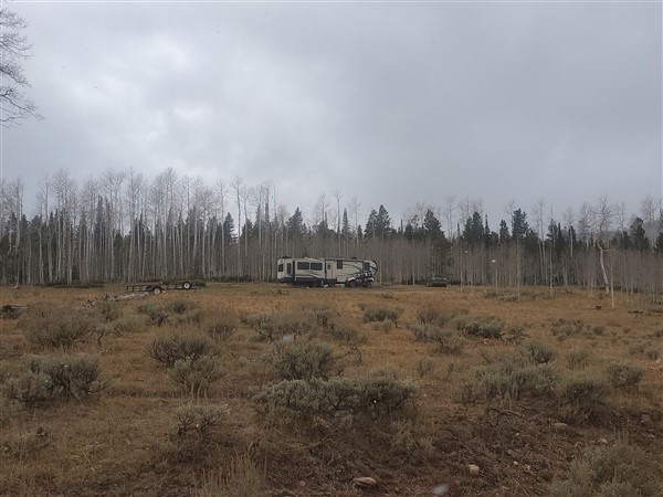
The total distance between Vernal and the Red Cloud Loop is about 20 miles. About 5 or 6 miles before you reach the loop, a sign noting a 16 day camping limit tells you you’re now on federal (BLM?) land. No sooner had I crossed onto Federal land, I noted an old motorhome about 50 yards off to the right from Taylor Mountain Road. Taylor Mountain Road at this point was a packed dirt road as the pavement ended a couple of miles back.
The road is smooth enough to take RV’s up there, and there are some large, relatively flat meadows where (at this time of year) hunters gather. I saw several camps as I drove towards the Red Cloud Loop, and a few along the loop.
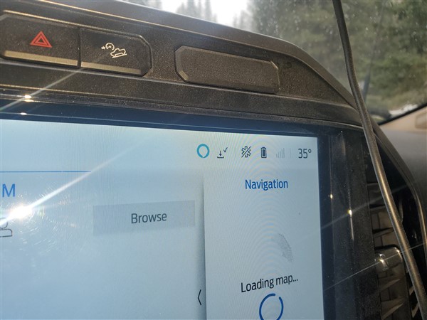
Temperatures hovering around 34-35F
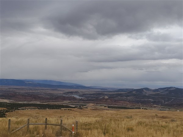
The Red Cloud Loop “Scenic Backway”
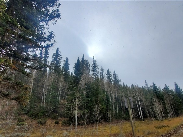
The loop itself runs about 50 miles. When I reached the loop, it was already snowing at a good pace (see the video – and be sure to watch to the end for some “bonus” footage!) The loop has a maximum elevation of 9975 ft. The stretch I drove (about 10 miles), I’d estimate was 9000 ft. above sea level give or take a couple of hundred feet.
When I first arrived, I turned left (west), drove for a couple of miles just to check out the terrain, then made a K-turn and headed east, until I ultimately reached pavement and Highway 191, which connects the Flaming Gorge (to the North) to Vernal (to the South.)
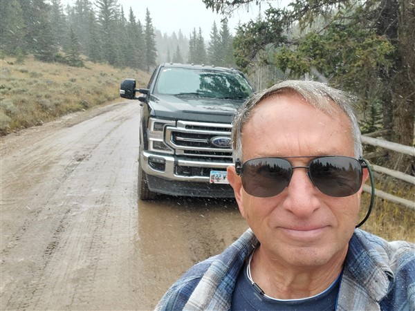
While I was able to drive the loop in the default 2-wheel drive mode in my F-350, I did have to slow to 15 mph at times as the road is narrow, somewhat rocky, slick from the falling snow (wet not ice), and there’s a notable drop-off on the right side.
Again, you can bring RV’s up to the Red Cloud Loop, but if it were me, I’d come up from either the Taylor Mountain Road side or the Highway 191 side and camp near but not along the Red Cloud Loop. That in fact is what most of the RV’ers I saw dry-camping up there appeared to have done. Camping near as I can tell is free in this region, within the 16 day limit.
The Red Cloud Loop: Summary Thoughts
The Red Cloud Loop truly is a “mini-journey” from Vernal. In no way does that diminish how spectacular it is – and accessible from Vernal, Utah. Driving the loop is exhilarating and gives you a true sense of the Unita Mountains – again unique for being an east-west oriented mountain range.
I’m glad I took part of an afternoon and went up there. I may even boondock there some time, probably accessing from the west (Taylor Mountain Road.) This would afford one the opportunity to explore more of the loop. Recall, I only drove about 10 of the 50 miles.
Be aware that this is a natural, remote area and no cell service is available. Since open fields and meadows do exist, RV’ers can probably expect good satellite connectivity in this region.
If you enjoyed this post, please check out some others and consider joining my newsletter below to be notified when a new post is created – all about RV travel and RV life.
Almost, but not quite my back yard….90 miles. It is a little less traveled area up there by Vernal. I like these types of posts: take us there, peaceful, relaxing, some information, etc. 🙂
Thanks! I try to “mix it up” with a variety of types of posts. Hope you’re doing well. Al