Reflecting back to Spring 2025… A 4 day excursion with Isaac into The Swell – each day was an adventure! A focus on RV Life, what Central Utah has to offer and into true friendship…
But first… a quick note about Winter Life in the Silver Valley of North Idaho ’25-26…
As I prepare this post, I’m about ready to post and it is the 8th day of April. Winter for all intents and purposes is OVER. And what a winter! A February (and March) heatwave. Several days in each month warm enough to pull out my recumbent trike and ride in shorts (at 47 North latitude!)
We’ve had snow, but it was often followed by HEAVY rain and WARM periods. I’m sure you’ve heard about the warm and dry conditions in Colorado and Utah. Well, North Idaho is not far off. Lookout Pass will likely see its final day on April 12th. And this year, that is longer than most other ski areas!
I have enjoyed skiing and ski instructing at Lookout Pass. In fact, my last teaching day will likely be Thursday April 9th! I DO plan to return to North Idaho and to Lookout Pass Ski Area in November. And YES, hopefully the ski season ’26-27 will begin IN November 2026! Until then, if fuel prices don’t go too much higher (diesel is 5.50 today here), I’m going to hit the road before May 1 and spend some time in the Intermountain West.
Until then, I’m going to catch up on stories and journeys to share with YOU…
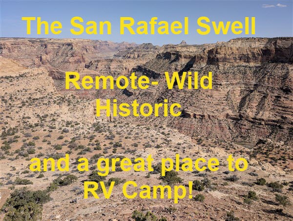
Let’s talk about a visit Isaac and I took to the San Rafael Swell just about 1 year ago…
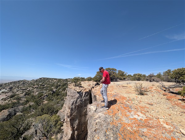
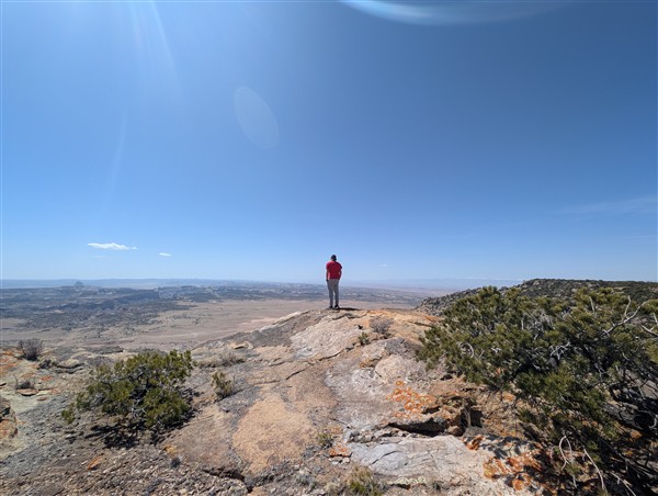
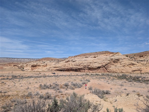
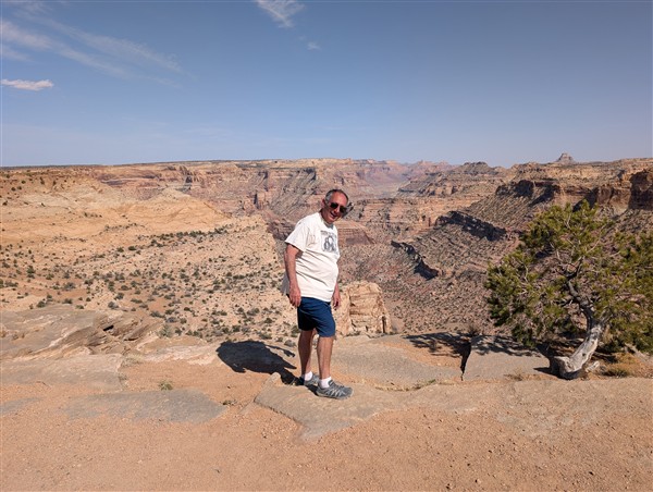
The San Rafael Swell – Remote (desolate) Utah and VERY quiet – we started our exploration at the Cedar Mountain Overlook (see map below for details)
The San Rafael Swell is a geographic region of about 217,000 acres, situated in Central Utah. To put that in perspective, this region is about 1/3 the size of Rhode Island! It is a vast region. The town of Huntington, Utah is located on the western edge of “The Swell.” If you were to drive from Huntington to Hanksville, Utah, for the 123 mile journey, you’d be skirting around the western and southern edge of The San Rafael Swell.
The M-K Tunnels – a historic site of significance
The Swell is so remote it was once considered as a viable location for NORAD (North American Aerospace Defense Command.) The MK Tunnel remains are the speculated location that was under consideration at the time before NORAD was built near Colorado Springs. (Source HERE.)
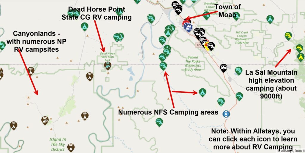
“Nearby” (by Utah standards) are the towns of Green River and Moab. Canyonlands National Park, Arches National Park, Dead Horse Point State Park are all located in this region as well. Isaac and I stayed in Green River as we explored this vast region. The camper remained camped in Parowan as it had been all winter.
All three parks named above have RV campsites. There are also numerous other RV camping options in this spectacular region. I’ve “ordered up” an Allstays map (below) to highlight camping opportunities in this region.
April 9, 2025 – The San Rafael Swell – Day 1
Nearly 10 months ago now, Isaac and I explored The Swell and the surrounding region for 3 full days. As I started preparing this post, I realized it will require multiple posts to adequately share all that we did during this trip. This post covers our “Day 1” experiences.
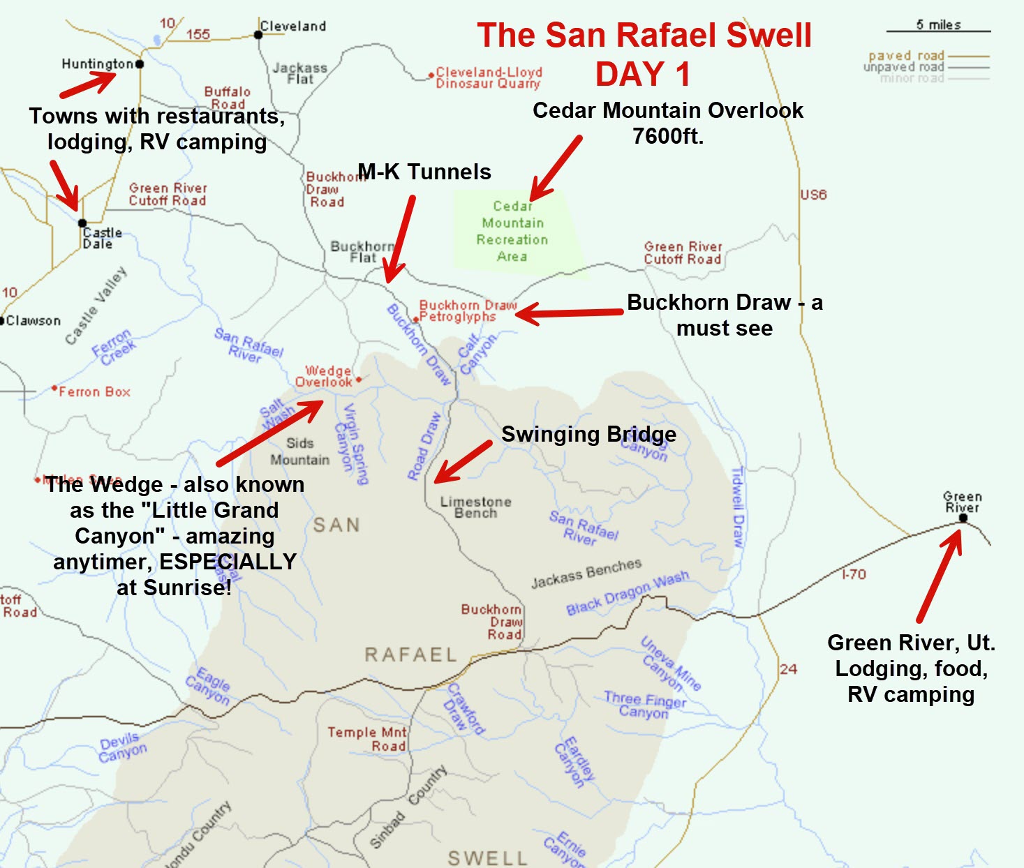
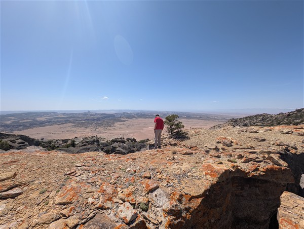
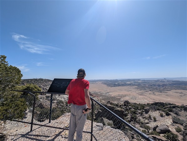
We started our journey by making a 5 hour drive from Parowan to the Cedar Mountain Overlook in the Swell. The closest town to approach from is Castle Dale. The Cedar Mountain Overlook is situated at about 7600 ft. elevation. It provides numerous inspiring overviews of the region you’re about to explore.
Visiting The Swell? Be prepared…
Know that this is an arid region and in the summer it can be quite hot and dry. Be sure to bring adequate water and know its a natural region. In other words, there are NO snack shacks in the region! We visited here on April 9. Temperatures were a seasonal high 70’s. Later in Spring or in the Summer, temperatures in the 90’s (or higher) are common.
A quick thought about buying an RV Camper…
In addition to being a full-time RV’er (since 2011), I’m an Independent RV Concierge (Consultant.) I have NO affiliation with ANY RV dealer OR manufacturer. I often share with my clients the thought that RV salesmen make used car salesmen look like angels!
Given the current (sad) state of affairs among RV manufacturers and the quality (or lack thereof) of the product they produce, I work with my clients to ensure they get a well constructed camper, with the right design for their needs at best possible price.
If you’re in the market for an RV (of any type) and/or selling your current camper, you can learn more about me and my Concierge RV Buying and Selling Service HERE.
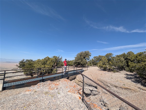
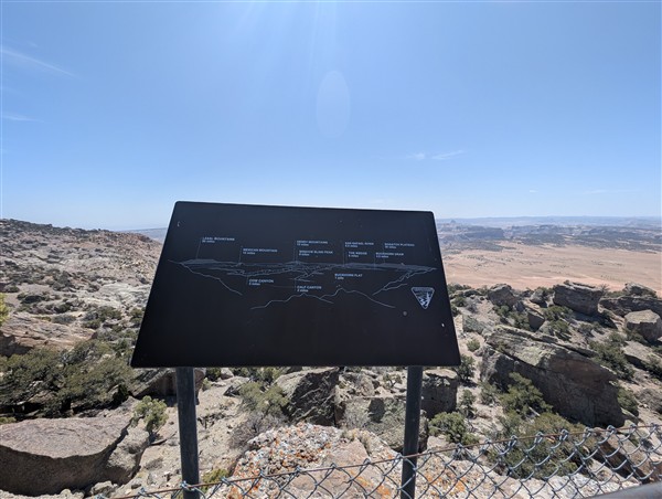
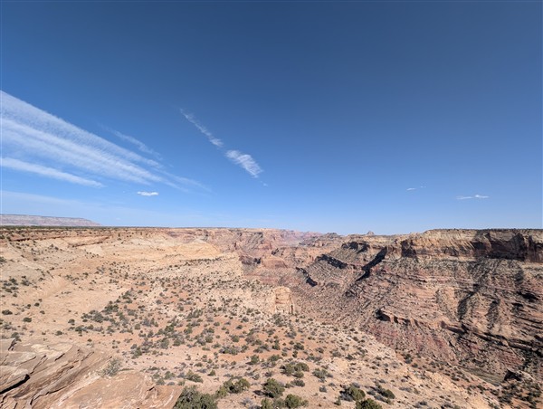
Cedar Mountain Overlook – a bit more…
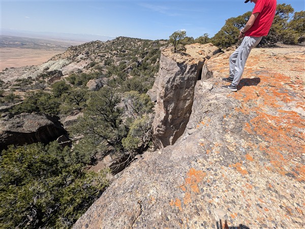
You can hike around the Cedar Mountain Overlook region. There are numerous vertical cliffs in the region. There are also informational boards that inform visitors of what there is to see in this region from this vantage point.
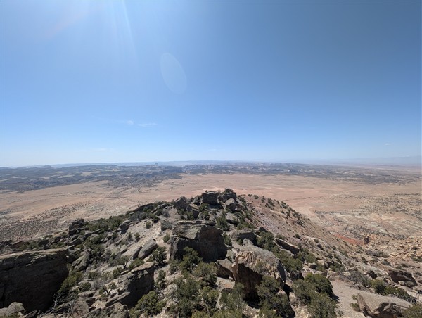
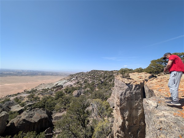
We probably did about two miles of walking as we explored the cliffs and overlooks. Even though Isaac is from Utah (St. George), I believe this was his first visit to this amazing region. It was evident in his awe of where we were and what surrounded us! I had visited a few years earlier, but more about that later.
M-K Tunnels – A significant and mysterious historical site (unraveling the mystery)
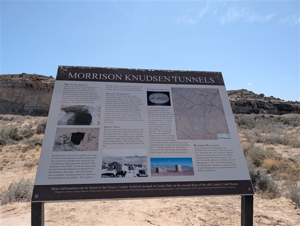
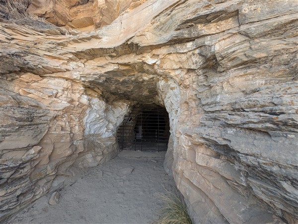
As we departed the Cedar Mountain Overlook, amazingly, Google Maps was able to guide us to the M-K Tunnels on truly secondary (dirt) roads. The entire region is unpaved, but the roads are maintained in pretty good condition. And yes, despite the remoteness of the region, I had a Verizon signal for much of the journey.
The pullout to the M-K Tunnels is unremarkable. Marked only by a sign that talks about the historical significance of this region. The trail leading to the tunnels is probably about 0.5 miles and is easily traversed after one somewhat steep decline early on.
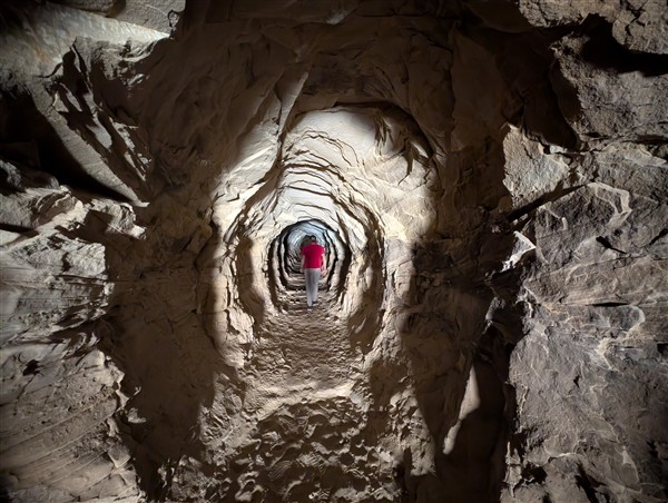
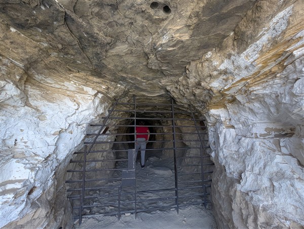
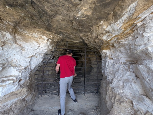
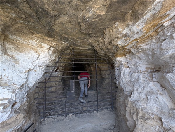
When we arrived at one of the tunnels, it was gated and blocked. Isaac’s curiosity got the best of him and he found a way to enter! So… we both actually entered into the tunnel. It was truly eerie – especially knowing the rumored history of this region. The tunnel was less than 1/4 mile in length, but deep enough to reach near complete darkness (without flashlights.)
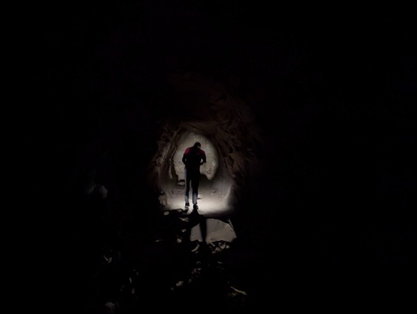
It was noticeably cooler inside the tunnel and the end was a solid rock wall. One can only wonder if anything lies beyond the (apparent) end of this tunnel!
After our brief hike, we returned to my trusty Ford truck and continued onto the Buckhorn Draw petroglyphs.
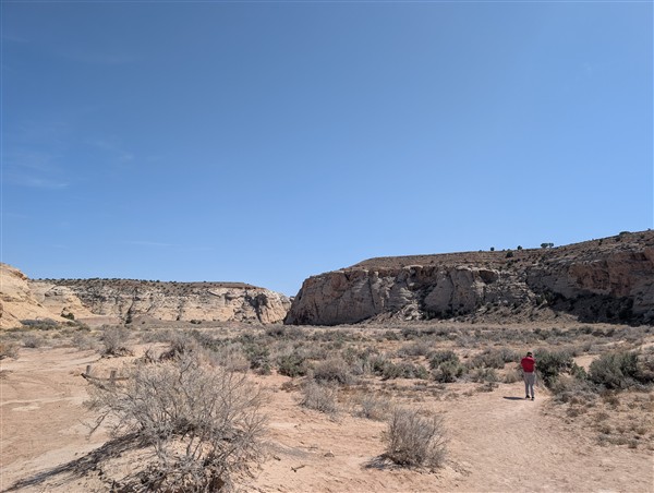
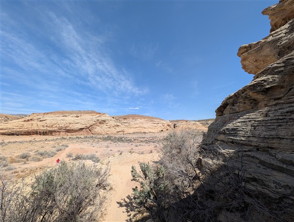
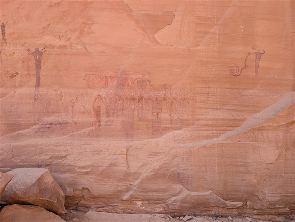
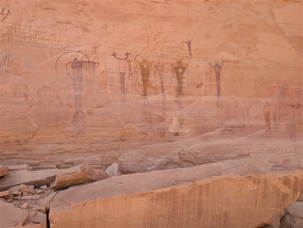
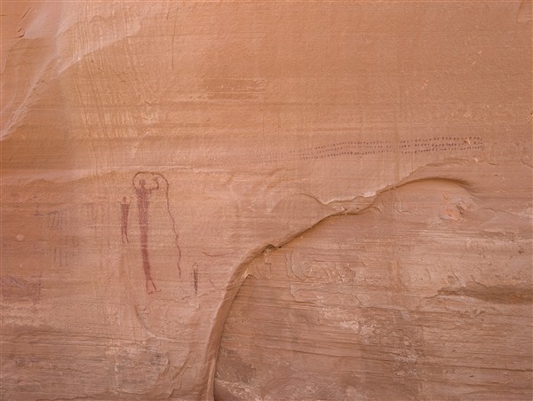
Buckhorn Draw Petroglyphs
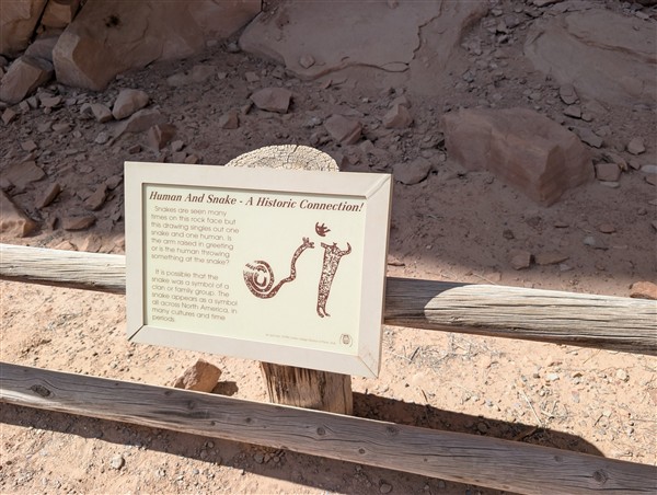
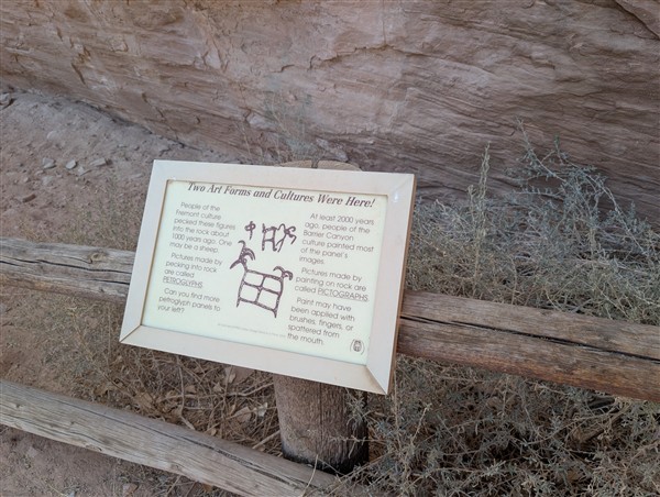
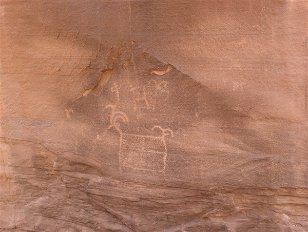
The Buckhorn Draw Petroglyphs are a mix of painted and etched images in vertical sandstone walls. Created by prehistoric tribes dating back at least 2000 years from today. It is the up to you to assess the meaning of these images. Experts have certainly offered their insights. I would say yours are likely as valid as theirs!
RV Camping near the Petroglyphs
The San Rafael Swell is a remote, primitive region. In my earlier visits to this region, I noted many primitive (no hookup) RV camping sites. Pretty much any pullout or wider area near a cliff was considered “fair game” for RV camping. There was, of course no fee to camp in such areas. I believe I had seen at that time the usual 16 day (or so) advisory as a limit to how long you could camp in this region.
Just south of the Buckhorn Wash are now numbered and boundary marked RV campsites. Each is marked by a placard and an advisory that you’ll have to pay the government (BLM) between $15 and FIFTY dollars per night you stay in these PRIMITIVE sites. Really?! Is our government THAT DESPERATE for a few bucks as to create revenue in this region? I guess the answer to that question is YES.
In all fairness, the $15. fee is for individual sites and the $50. is for larger group sites.
There are many other unmarked areas where I’ve seen RV’s camp in the past. With this unfortunate turn of events, I do not know the legal status of using these areas to camp. I suggest you seek out a ranger when visiting the region (or call them 435-636-3600) and inquire as to where you can camp for free – if anywhere now!
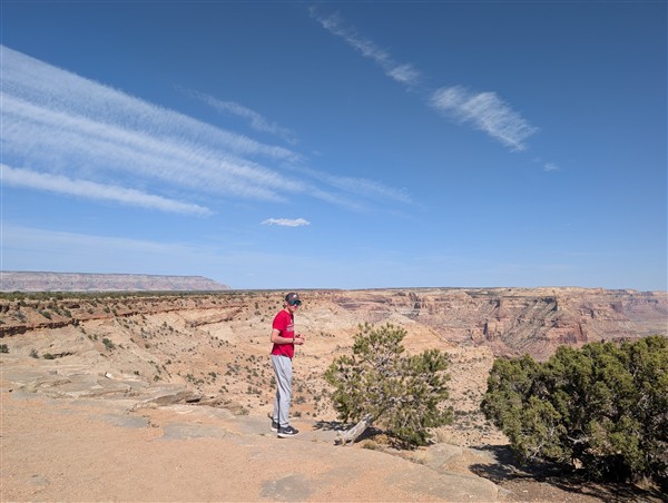
The Wedge…or the Little Grand Canyon
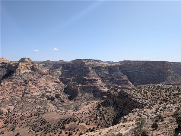
For me, this was a return visit – before my heart attack, before a lot happening in my life and before my travel bud Isaac. It was an INSPIRING early morning visit, sunrise actually in August 2019. Now, in 2025, I had some idea of the road that led to the Wedge. And this was a good thing!
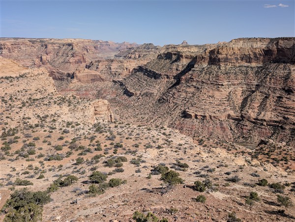
The Wedge is also known as the Little Grand Canyon. The San Rafael river runs through it. When standing along the rim, you’re at about 6200 ft. elevation. The San Rafael river sits about 1000 ft. below your vantage point.
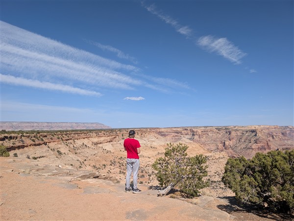
We arrived in the mid-afternoon. Hiked along the rim taking in the view and the entire scene. There’s truly nothing (in the way of civilization) there. You can easily do a couple of miles of hiking in this area. Mountain biking is also done here. There is a 30 mile trail in and out that you can mountain bike along the rim.
The Wedge RV Camping options
There are also campsites which *mostly* accommodate shorter campers (under 27 ft.) You can search the Wedge or visit allstays for more detailed information as to what will fit and whom to call to get local information about camping near the Wedge. The camping is near but not along the rim of the Wedge. This allows for day parking and picnicking near and along the rim. I believe there IS a fee for these sites. As with the entire region, the BLM manages it and does NOT charge for camping near the Wedge.
After taking in the scene, as the day had involved lots of driving and we still wanted to stop by the swinging bridge, we headed south, closer to I-70 and our destination in Green River for the next 3 nights.
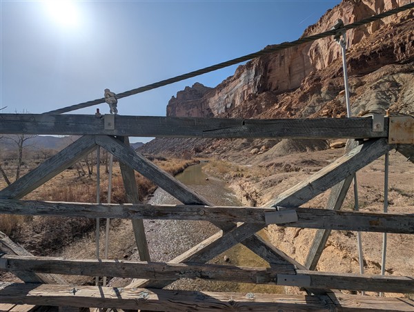
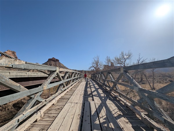
San Rafael Swinging Bridge
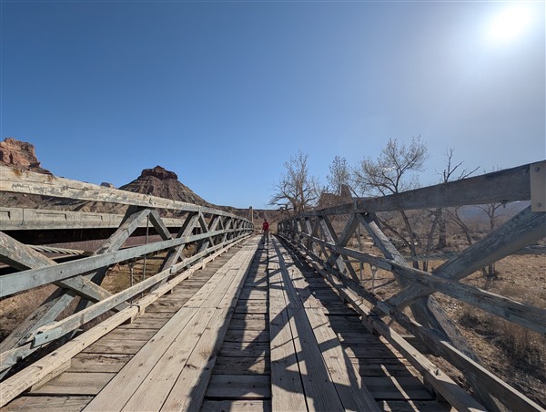
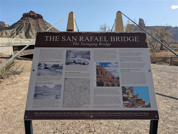
The Swinging Bridge is an historic suspension bridge that facilitated crossing the San Rafael River. It is the oldest suspension bridge still intact in the state of Utah. It was completed by FDR’s CCC in 1937. You can see evidence of workmanship not present on modern bridges. The deck is wooden and pedestrians are still allowed to cross it.
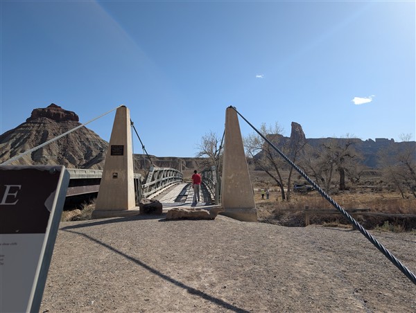
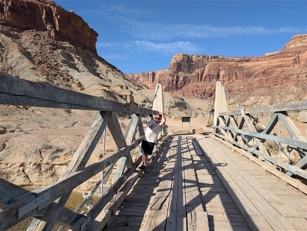
The early 1990’s saw the last cars drive over this bridge. In 1992 a more modern bridge was built right next to it. At the same time, the San Rafael Bridge was added to the National Register of Historic Places. We’re fortunate to have this great example of Roosevelt era construction still standing and accessible to all who venture into the Swell.
San Rafael Swinging Bridge RV Campground
There is a campground maintained by the BLM right next to the Swinging Bridge. It is a fairly large campground and there are lots of opportunities for high desert recreation in the area. Not the least of which is to do something like what Isaac and I did that day! As with most BLM campgrounds, don’t expect hookups and don’t expect to pay much.
Reservations are likely needed and the latest fee information I was able to obtain suggests a $15. per night fee. Again – primitive campsites.
Wrapping up an AMAZING day
After the Swinging Bridge, we proceeded south to I-70. It was the first pavement we had seen in many hours! This marathon day saw the last of our exploration of the northern half of the Swell. We both knew that much more lay ahead on this journey!
After about an hour of travel on I-70, we arrived in Green River. We checked into our motel, took time for a soak in the motel’s hot tub, and then found some grub and later even a good ice cream place. The warm “summerlike” evening weather made it all the better as we were still adapted to winter in the Parowan area which was still chilly.
There’s MUCH more ahead as I pull together our subsequent explorations. If you enjoyed experiencing this region, I’d love to hear from you. Have you visited The San Rafael Swell? Do you have any plans or desire to do so? I’d welcome your thoughts in the comments section below. The YouTube video (posted above) tries to share a bit about our visit. If I was successful, please visit the video on YouTube and leave it a thumbs up and even a comment. Thanks!
Need “tried and true” RV Accessories? Here are my personal recommendations…
Want to be notified of future posts as they arrive? Sign up for my free newsletter to be notified of upcoming posts.